 If asked to identify the most significant accomplishment of the English geologist William Smith, some may point to his discovery that rock layers could be identified by the unique fossils they contained. Others would perhaps indicate that he was the first person to map the geology of an entire nation. However while there may be differences among those familiar with the life and extensive works of this remarkable man, all would likely agree on the fact that the maps he created to document his researches and discoveries are both remarkable in their effectiveness as well as exquisite in their beauty.
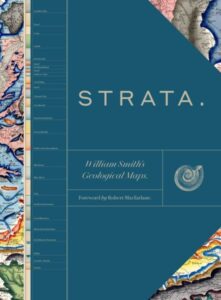
To bring Smith’s revolutionary discoveries as well as the glory of his maps to the wider reading public, The University of Chicago Press has published the first complete presentation of his works in their lavishly illustrated, large format book Strata; William Smith’s Geological Maps.
Edited by a team from the Oxford University Museum of Natural History, with an introduction by Douglas Palmer and a forward by Robert Macfarlane, this sumptuous book presents its readers with Smith’s full-color geological maps, as well as tables of strata, geological cross-sections, photographs, and fossil illustrations from the archives of the Oxford University Museum of Natural History, the Geological Society, London’s Natural History Museum, and other similar noble institutions.
It is both a book to be attentively read for the wealth of information it contains as well as one with which to relax and allow oneself to be overcome by the – dare I say, given the prevalence of so many sensuous soft curves in the formations therein so delicately depicted, voluptuous? – beauty of its lavish, colorful maps and illustrations. Just be sure to brew an extra large pot of tea and have it near to hand before sitting down with the book so you won’t need to bestir yourself once you’ve opened its pages and settled in for the duration.
If you enjoyed reading this, please consider signing up for The Well-read Naturalist's newsletter. You'll receive a helpful list of recently published reviews, short essays, and notes about books in your e-mail inbox once each fortnight.