Back in the early 2000’s, I had the honor and privilege to work on the Oregon Birding Trail Project. The idea of birding trails is a fairly simple one: collect and organize information about the most popular, most interesting, and most reliable birdwatching locations in a designated geographical area, create easy-to-use maps linking the locations together, and then publish it all with additional supporting information in a pamphlet or guidebook (and now often via a website as well) in order to enable local and visiting birdwatchers alike to find sites at which to practice their craft, add to their life lists, and increase their opportunities to enjoy nature. Not surprisingly, these trail guides are very handy indeed not only for birdwatchers but for other natural history enthusiasts as well in the information they include. Whenever I am traveling and have the time to engage in any birdwatching or naturalizing beyond “crime of opportunity” observing, I seek to learn if the area in which I am sojourning has a birding trail guide.
 Recently, a new birding trail guide came to my attention: the newly revised and updated edition of the Ohio Lake Erie Birding Trail Guidebook. This 120-page, ring-bound (for improved ease-of-use in the field) covers the northern Ohio shoreline and adjacent area from Conneaut on the Pennsylvania border westward to Swanton on the Indiana border. The Ohio Lake Erie Birding Trail features ninety of the region’s most interesting and popular birdwatching sites, all organized and mapped as seven habitat-related loops to enable more geographic, habitat, or species focused trip planning. Each of these loops can be followed as presented or sub-divided accordingly in relation to the amount of time available.
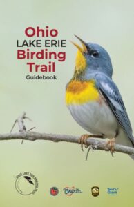
The seven loops included in the guide are the Ashtabula Loop, Cleveland Area Loop, Huron & Lorain Loop, Sandusky Bay Loop, Lake Erie Islands Loop, Western Lake Erie Marshes Loop, and the Oak Openings Loop. Each loop presented begins with a general explanation of the area it covers, the most common species seen at the sites it includes (as well as noteworthy rarities, of course), and particularly notable “hot spots.” Following this, each loop section presents its sites individually, with each site presentation including directions to it (including GPS coordinates), amenities (when you have to go you especially need to know), public access times, an overview of the site, likely visible species, known rarities that may be seen there, a citation of the site’s sponsor in the guidebook, a lovely photo of a bird relevant to the site, and QR codes that lead the reader to additional information that is available online. As would be expected of any worthwhile birding guide, a master checklist of species covered by the sites presented is included at the end of the book as well as on the removable folded map included in a handy pocket inside the front cover of the book, as are points of contact to learn more about related programs and resources offered by the Ohio Division of Wildlife and Ohio Sea Grant.
The Ohio Lake Erie Birding Trail Guidebook has a cover price of $15.00 and can be purchased online or at visitor center locations throughout the relevant area, such as the Magee Marsh Wildlife Area visitor center, the Black Swamp Bird Observatory, and the Ottawa National Wildlife Refuge visitor center. All birdwatchers living in the area should consider adding a copy to their reference library; all birdwatchers (and more general naturalists as well) who are visiting the area from elsewhere – particularly those traveling in for The Biggest Week in American Birding – should consider this guidebook a must-have ready-to-hand resource that will help them make the most of their time afield.
If you enjoyed reading this, please consider signing up for The Well-read Naturalist's newsletter. You'll receive a helpful list of recently published reviews, short essays, and notes about books in your e-mail inbox once each fortnight.