They were special books – you could tell that just from the fact that they were kept in an unique set of shelves all by themselves in my middle school’s library. And of course by their size – they were so large that the set of shelves in which they were kept had a slanted reading stand atop it just to hold them in place while they were being used. No student could check one of them out; they always remained in the library so the librarian could keep them under close supervision.
Most of us however, rarely used them. Only when a history report called for a map of a particular country to be included did they get much attention; and then it was only accorded long enough for the map of said country to be traced on a piece of notebook paper. In fact, it really wasn’t until I became an adult that I began genuinely to appreciate the value of a good world atlas; to understand just how much important information was to be found between their enormous covers.
For those who might not have opened a printed atlas since middle school, the publication of the twenty-third edition of the Oxford Atlas of the World provides an excellent opportunity to give renewed consideration to why these massive tomes were accorded such pride-of-place in the school library. And should mid-life reflections upon one’s school days not be sufficient reason for doing so, here’s a more present day example: nothing on the Internet is permanent – or as the political events of 2016 show, always reliable.
Here is perhaps where my somewhat Luddite bias toward print may show itself (and yes, I am well aware that this essay is being published over the Internet I often criticize). Books published by well-established and thoroughly respectable publishing houses, such as in this case Oxford University Press, are written by some of the foremost scholars in their respective field, and then rigorously edited and fact-checked by a number of highly experienced professionals. The very reputation of the press itself rests upon the veracity of the books it publishes. And in the case of printed books, what is published will exist, available to all who are capable of reading the language in which it was written, just as it was from the day it came off the presses until it physically ceases to exist. I can take down any book from my shelves and it will show me precisely the same text, illustrations, maps, and charts that it contained the day I purchased it. No one can ever change “one jot or one tittle” in it without breaking into my library and physically defacing or destroying it. (And as we were clearly shown in 2009, this is not something that can be said of electronic books).
So what does this all have to do with this new Oxford Atlas, you may ask? Just this:
Oceania was at war with Eurasia and in alliance with Eastasia. In no public or private utterance was it ever admitted that the three powers had at any time been grouped along different lines. Actually, as Winston well knew, it was only four years since Oceania had been at war with Eastasia and in alliance with Eurasia. But that was merely a piece of furtive knowledge, which he happened to possess because his memory was not satisfactorily under control. Officially the change of partners had never happened. Oceania was at war with Eurasia: therefore Oceania had always been at war with Eurasia. The enemy of the moment always represented absolute evil, and it followed that any past or future agreement with him was impossible. (George Orwell, 1984, book 1, chapter 3)
Without a physical point of reference from the past, Winston Groom was largely unable to verify that which he himself remembered to be true in the face of what the government of Oceania stated to be otherwise. Not to put too fine a point on it, but we are – much to the horror of many of us who have long tried to govern our lives by reason and fact – moving into a “post factual” world; a world where leaders make statements completely contradicting things that are demonstrably (at least for now) true.
Even as I write this, scientists across the United States who have worked on projects dealing with global climate change are busy copying data out of very justifiable concern that it will be destroyed at the direction of decidedly climate-change-denying appointed members of the incoming administration. Far less complex in its content than what these scientists are diligently copying, pages 80-81 of the new Oxford Atlas of the World contain a very easy-to-understand summary of the present state of knowledge on the subject that will continue to inform anyone who reads it so long as the book itself physically exists.
In addition to this summary of the present understanding of climate change, the Oxford Atlas also contains the most recent information on such diverse subjects as biodiversity, global wealth, agriculture, current international as well as intra-national conflicts, and a variety of other subjects stories about which fill the pages of better newspapers every day. Would that we could train ourselves, each time we read or heard some geographic reference of which we were ignorant, to cut a straight path for our trusty atlas in order to learn the basics and background of it in order to declare upon a foundation of facts “Yes, I see how that matters to this story,” or even more importantly “No, that misrepresents the subject by…” But then perhaps I ask too much.
Then, of course, there are the full-page maps. Maps of nations, regions, and cities; maps depicting political boundaries, geologic features, and human-constructed infrastructure. Since the advent of GPS and Google Maps, many people have stopped learning how to read complex printed maps, and even of those who still can, fewer still take the time to sit and contemplate them for professional or personal edification. Yet it is by doing so that so much about the world can come more clearly into focus. Yes, they are of course indispensable for reference, but by sitting in contemplation of the map of a continent, nation, region, or city, things begin to make themselves apparent that were before perhaps abstract or little more than a series of names. When you hear of the civil war in Syria, do you immediately understand where it is or know what nations border it? What about South Sudan? Do you know why Bangladesh takes so much damage and sees such high casualty rates whenever a tsunami strikes the region in which it is located? Or how many different sovereign nations contain rivers that drain into the Amazon? These are all things easily discoverable simply by spending a little leisure time each evening with the Oxford Atlas open on a reading stand or table in front of you.
Enough. I have surely written more than sufficient words to make the case for adding a copy of the new twenty-third edition of the Oxford Atlas of the World to your library at the earliest opportunity. And as this particular atlas is updated each year by Oxford, to watch eagerly toward the end of 2017 for the twenty-fourth edition in order to place it squarely beside this present one on your shelves for ready access to answer any geographic question you may have about the present or the past – and, should it regrettably become necessary, to provide documented proof that Oceania has not always been at war with Eurasia.
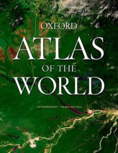 Title: Oxford Atlas of the World; Twenty-Third Edition
Publisher: Oxford University Press
Format: Hardcover
Pages: 448 pp.
Published: October 2016
ISBN: 9780190634285
In accordance with Federal Trade Commission 16 CFR Part 255, it is disclosed that the copy of the book read in order to produce this review was provided gratis to the reviewer by the publisher.